3D Urban and Terrain Modeling

Do you want to know exact information about the location you manage?
Thanks to cutting-edge technologies, we can create precise 3D models of terrain or cities. Digital twins provide descriptive information about the landscape, making management and planning easier. We conduct ground and aerial imaging, using cameras for optical and thermal sensing, as well as hyperspectral sensors. We utilise LiDAR technology and photogrammetry. These 3D models offer detailed information about the area and find applications in various fields.
How is a 3D model created using LiDAR technology?
Light Detection And Ranging (LiDAR) is a method for rendering a scanned object or the Earth’s surface using lasers. The following steps lead to the creation of a 3D model:
• Data Collection with LiDAR Sensor and Point Cloud Generation
LiDAR technology emits laser beams toward objects of interest, which then reflect back to the recording device. The acquired data is processed into a point cloud, containing a large number of 3D points representing the shape, dimensions and location of objects of interest on the Earth’s surface. Based on concurrently captured aerial imagery, we colorise the resulting point cloud with real-world colors.
• Classification of Point Clouds and Digital Model Creation:
By categorising the points within the point cloud, we obtain specific groups of interest. From these, we create digital models:
Digital Terrain Model (DTM): Includes only the Earth’s surface without vegetation, buildings or other anthropogenic features.
Digital Surface Model (DSM): Provides elevation information about vegetation and other natural or artificial objects.
Additionally, one visualization method involves texturing the models using aerial imagery.
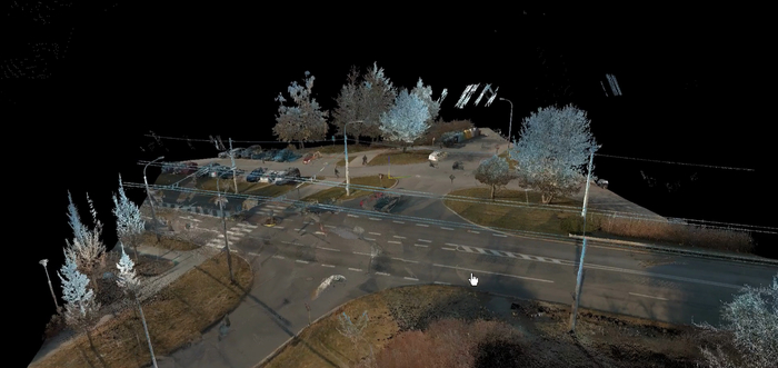
Colored Point Cloud


Digital Terrain Model
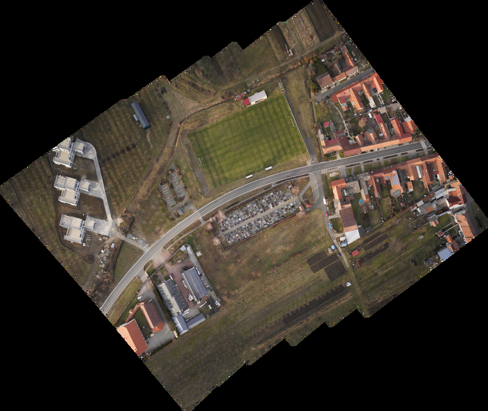 |
| Orthophotomap |

What is the use of a 3D model?
3D terrain and surface models are valuable tools not only for experts but also for the general public. They provide descriptive information about landscapes, buildings and other objects, and are compatible with CAD/GIS data formats. These models assist in monitoring landscape changes, analyzing watersheds, developing renewable resources, precise agriculture, environmental protection and defense planning. 3D city models can be utilised in transportation development and urban planning. They are useful for presenting development projects to the public, allowing citizens to better understand the future evolution of their communities through 3D models. Additionally, they play a crucial role in the digitalisation and creation of BIM (Building Information Modeling) for technical and transportation infrastructure. Digital models are also essential for spatial analyses, such as noise propagation and natural risk assessments, as well as other environmental aspects. They have become indispensable tools for cities striving for modern development.

Are you interested in our offer? Do not hesitate to contact us via email: mdpgeo@mdpgeo.cz